

Stockpile & Earthworks
Aerial Measurements
We use state of the art drone technology to collect precise stockpile volumes and cut/fill calculations for confident material tracking, billing, and earthwork verification. Reliable data you can document, compare, and stand behind when accuracy matters.
Sample Project
Commercial Gravel Yard
Inventory Reconciliation
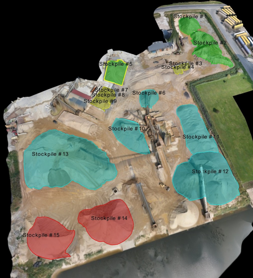
A commercial aggregate supplier needed an inventory count on active stockpiles before a quarterly billing cycle. Manual wheel measurements had produced conflicting numbers between the supplier and their client.
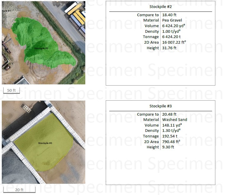
With our drone we flew the yard in a single 25-minute mission, processed the point cloud overnight, and delivered a highly accurate volume report the following morning — well within the 48-hour window. Each pile was measured individually against a flat reference plane, with results broken out by material type.
Deliverables Provided
What We Do
Know Your Numbers
we help get it right
Accurate volume measurements of stockpiles, excavations, and earthwork eliminate the guesswork from material ordering and billing. We fly the site, process the point cloud, and compare current conditions against your design surface to produce an accurate cut/fill report.
Our reports are built by professionals — we know what your grading superintendent, project manager, and owner need to see, and we format the data accordingly.
Use Cases &
Deliverables
Common Use Cases
- Stockpile inventory management
- Earthwork quantity verification
- Material billing reconciliation
- Contract dispute documentation
- Aggregate and material tracking
What You Receive
- Volume calculation report
- Cut/fill map
- Comparison to design surface
- PDF summary
- Point cloud data (.LAS)
Also Available
Other Services
Get Accurate Volume Data
48-hour delivery. FAA certified. Serving Arizona.